With the highest cliffs (750ft+) on the east coast, Whiteside Mountain is a spot you need to check out.
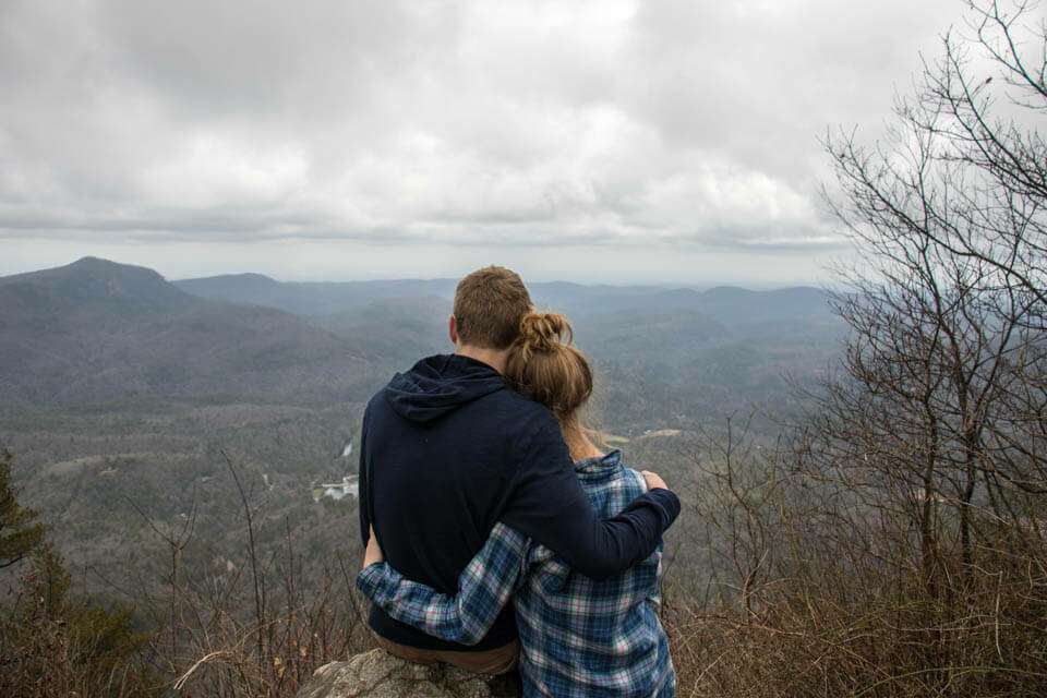

A nice view is always better with someone else. Who are you going to enjoy the view with? 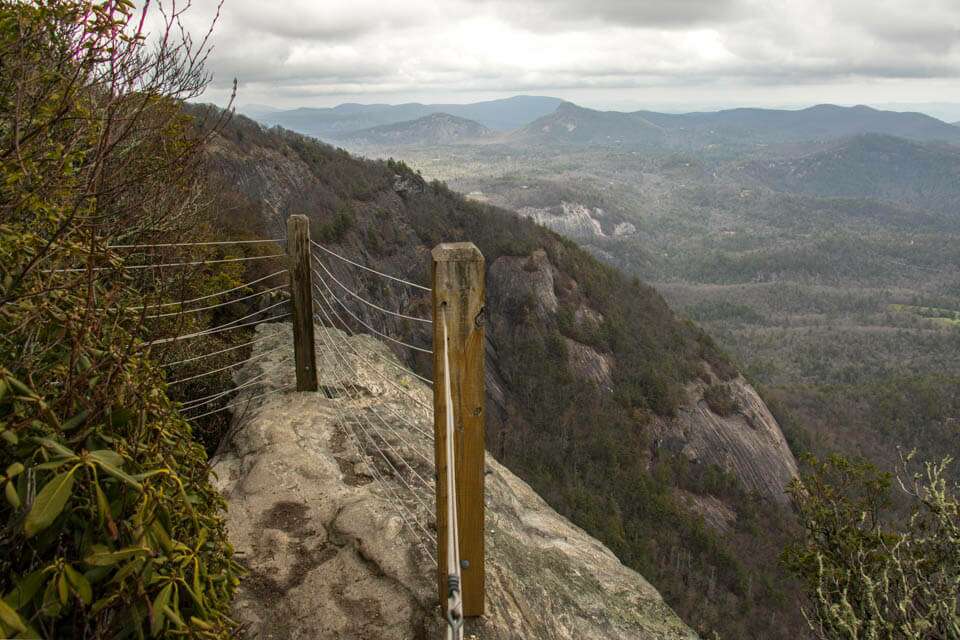
Whiteside Mountain has many viewing areas along the trail that traverses the top of the ridge. 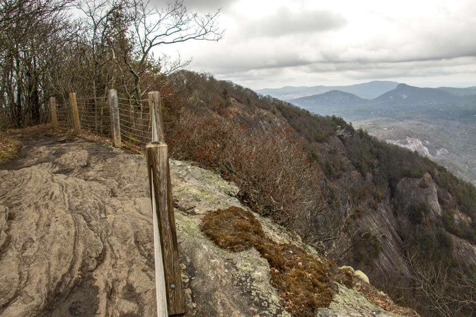
A daring rescue took place here in the early 1900’s. Read all about it from the informative sign above Fools Rock.
Just off Highway 64 between the Western North Carolina towns of Highlands and Cashiers, is the landmark mountain – Whiteside Mountain. Boasting the highest cliffs in Eastern North America, this 4,930 ft beauty is a magnificent site to see. It is also easily accessed via a 2 mile loop trail that takes you to the top of Whiteside Mountain right above sheer 750ft cliffs for spectacular views to the East, South and West.
The parking lot for the Whiteside Mountain loop trail is located at 170 Deville Drive in Highlands North Carolina. It is just 1 mile off Highway 64 on Whiteside Mountain Road. Whether you come from the East or West, the turn-off for Whiteside Moutain Road is about 6 miles from either Highlands to the West, or Cashiers to the East. There is also good signage on the road so it is really easy to find. There is a small fee of $2 per vehicle which is payable at a fee station in the middle of the parking area. The parking area is large and there are restroom facilities onsite.
The trailhead for the loop trail is right in the middle of the parking area right next to the fee station and between the informative sign boards. The trail is well indicated, marked with blue blazes, and very well maintained throughout the entire loop.
The trail immediately starts uphill and will pretty much continue the uphill climb until you reach the top of the ridge. Very quickly you reach a old service road that is now the hiking trail to the top. Turn left and follow this about 1 mile to the top. Soon you will pass by the return loop trail which you could take to the summit if you wanted to take the most difficult route up. Most people, including us, continue straight on the wide and steady trail up the back side of the ridge.
After about 1 mile, you reach the top of the ridge and the trail levels out. There are some nice views available along with an informative plaque. Take a little time to catch your breath and enjoy the view before following the level trail along the ridge.
The trail continues for about 1/2 mile with several viewing areas as you make your way across the high cliffs of Whiteside Mountain. The views are great and there are many of them. There are plenty of informative plaques including one about Fool’s Rock that you won’t want to miss. Read all about a daring rescue that took place in 1911 before walking through a narrow crack to check out Fool’s Rock for yourself. We thought this spot afforded the best views on the mountain.
Continuing down the ridge watch for the marker that indicates the highest point on the mountain at 4,930 ft.
Soon after this, the trail will start a steep 1/2 mile decent back down to the service road you initially started on. The trail gets you down the mountain quickly through a beautiful wooded forest, it’s in great shape and even has stairs in the steepest sections.
When you encounter the service road, turn left continuing downhill. Watch for the stepson your right leading off the service road back to the parking area to complete your hike of Whiteside Mountain.