A large rock outcropping and forest area that houses unique and rare plant species to explore and enjoy.
The forest at Forty Rock Heritage Preserve is exceptionally beautiful. 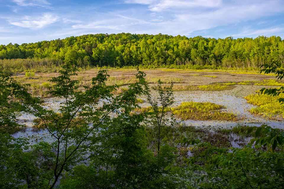
The beaver pond is a destination inside the preserve that shouldn’t be missed. It is teaming with wildlife! 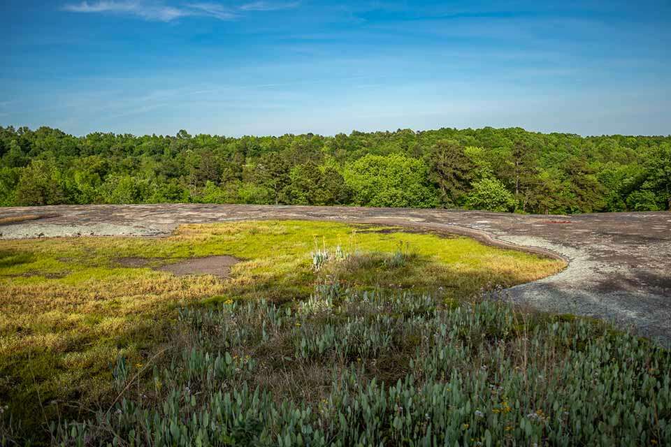
Contrary to the name, the rock at 40 acre rock isn’t actually 40 acres is size.
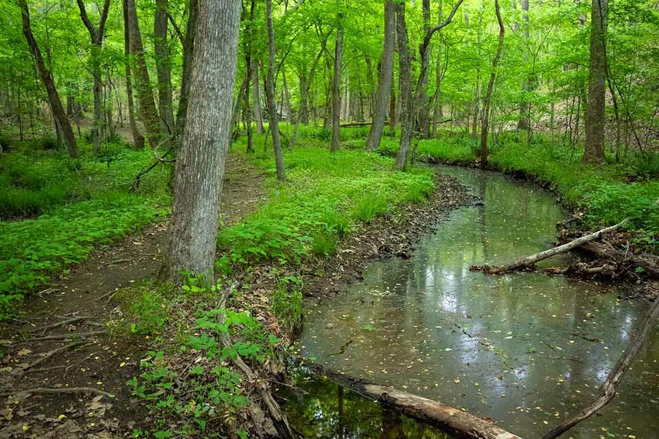
South Carolina’s Forty Acre Rock Heritage Preserve is a unique 2,267 acre preserve in the piedmont area of South Carolina. Although it is generally associated with the large rock outcropping for which it is named, which is only about 14 acres, there is a lot more to the preserve that includes a beautiful forest, creeks, a small waterfall, and large beaver pond that is abundant with wildlife. Unfortunately the rock is covered with excessive graffiti however the preserve and rock are still very beautiful and wonderful for exploring via the short tails that run through the preserve.
Forty Acre Rock Heritage Preserve is located in the town of Kershaw, South Carolina. There are two points of access into the park. The upper parking area, at the end of Conservancy Road, is the closest to the rock. The lower parking area, off Nature Reserve Road, is closest to the beaver pond. Trails connect both lots so you park on either side and still experience the entire preserve. Forty Acre Rock Heritage Preserve is about 75 minutes from both Charlotte North Carolina and Columbia South Carolina. There are no restroom facilities onsite.
Whether you start from the upper or lower lot, the trails inside the preserve are generally in good condition and well marked. Within the preserve, there are also a number of unmarked trails that you can easily wander on to if you are not paying attention. As you hike through the preserve, just keep a lookout for trail markings to stay on a designate route or feel free to explore the numerous unmarked walking paths.
There are three main trails within the preserve none of which are too difficult. The longest trail is about 2 miles in length and connects the upper and lower parking area. This trail passes by 40 acre rock, a short waterfall, a cascade, and the beaver pond. It provides a great overview of the park, is very well constructed and pleasant to hike along. The only difficultly we experienced with this trail is finding it from the rock side. When you approach from the upper lot and reach the rock, there are few trail markings. To find the trail, follow the forest line down the left side of the rock and look for a trail leading into the woods near the bottom of the hill. From here the trail is very obvious and should be well marked all the way to the lower parking area.
The other two trails make short loops from the main trail connecting the two lots. The upper loop is a short spur that follows along the top of the rock and then joins the main trail after entering the woods and descending a short hill. If you take this trail from the rock, head right immediately after crossing the small creek at the bottom of the hill.
The third trail is a 1.2 mile loop around the beaver pond that wanders through a beautiful section of the forest and provides the best views of the pond. This was a great trail and shouldn’t be missed if you visit the preserve.
Since the two loops form a loose figure eight, you can easily hike from one side to the other and return on the loops for a great preserve experience that is about 5 miles in total. If you just want to enjoy the rock or the beaver pond, the rock is about 2/10’s of a mile from the upper lot and the beaver pond is only about 100 yards from the lower lot.
The main attraction of the preserve, however, is the large granite rock that is a very spacious open area and interesting to check out. There are a number of depressions that form pools after rainfall. Rare and unique plant life form in these pools which are very colorful when in bloom. The plants create a beautiful patchwork of color and contrast along the wide rocky surface.
When you have finished enjoying forty acre rock, hike safely back to the parking area.
My wife and I visited area yesterday. We have visited park many times as we were reared in the area and use to swim in the old gold mine pond many years ago. It has been 15 or 20 years since we visited. We drove down A unpaved road past a couple of mobile homes. The Rd. ended at a barricade.
We walked down the blocked off Rd. for a good ways and did not see any markings or the top of the rock as we remember it. As we remember the Rd. ended at the rock. Does the Rd. we walked down end up at the Rock ? Is a areal view avaiable to assist in finding the rock. Is the parking area close to 601 the lower parking area? We have heard that in the past auto left un attended were broken into so we were apprehensive about leaving it for very long. As we left we passed a SUV with a lot of young folks in it comeing in. This was around 1:OO PM tuesday Nov. 9.